


La Fumade

cedric.fargues
User
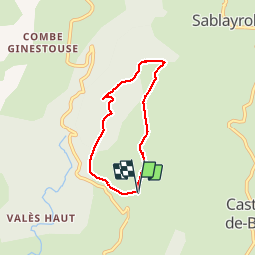

Length
5.5 km

Max alt
654 m

Uphill gradient
180 m
Km-Effort
7.9 km

Min alt
559 m

Downhill gradient
184 m
Boucle
Yes
Creation date :
2016-12-22 00:00:00.0
Updated on :
2016-12-22 00:00:00.0
1h58
Difficulty : Unknown

FREE GPS app for hiking
 SityTrail
IGN / Geographical institutes
SityTrail Plus
The world is yours!
About
Trail Walking of 5.5 km to be discovered at Occitania, Tarn, Fontrieu. This trail is proposed by cedric.fargues.
Positioning
Country:
France
Region :
Occitania
Department/Province :
Tarn
Municipality :
Fontrieu
Location:
Castelnau-de-Brassac
Start:(Dec)
Start:(UTM)
459053 ; 4833247 (31T) N.
Comments