


Dent de Cons

bourel.jacques
User
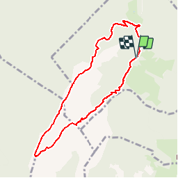

Length
8.1 km

Max alt
2040 m

Uphill gradient
920 m
Km-Effort
20 km

Min alt
1185 m

Downhill gradient
918 m
Boucle
Yes
Creation date :
2016-12-31 00:00:00.0
Updated on :
2016-12-31 00:00:00.0
3h56
Difficulty : Difficult

FREE GPS app for hiking
 SityTrail
IGN / Geographical institutes
SityTrail Plus
The world is yours!
About
Trail Walking of 8.1 km to be discovered at Auvergne-Rhône-Alpes, Savoy, Marthod. This trail is proposed by bourel.jacques.
Description
La Pointe de Cruessajaran et la Dent de Cons
Positioning
Country:
France
Region :
Auvergne-Rhône-Alpes
Department/Province :
Savoy
Municipality :
Marthod
Location:
Unknown
Start:(Dec)
Start:(UTM)
295316 ; 5068192 (32T) N.
Comments