


Alleves-Gge du Perchet

Bogapuki
User
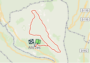

Length
8.5 km

Max alt
1291 m

Uphill gradient
643 m
Km-Effort
17 km

Min alt
646 m

Downhill gradient
640 m
Boucle
Yes
Creation date :
2018-11-25 09:19:03.355
Updated on :
2018-11-25 09:19:03.355
3h37
Difficulty : Medium

FREE GPS app for hiking
 SityTrail
IGN / Geographical institutes
SityTrail Plus
The world is yours!
About
Trail Walking of 8.5 km to be discovered at Auvergne-Rhône-Alpes, Upper Savoy, Allèves. This trail is proposed by Bogapuki.
Description
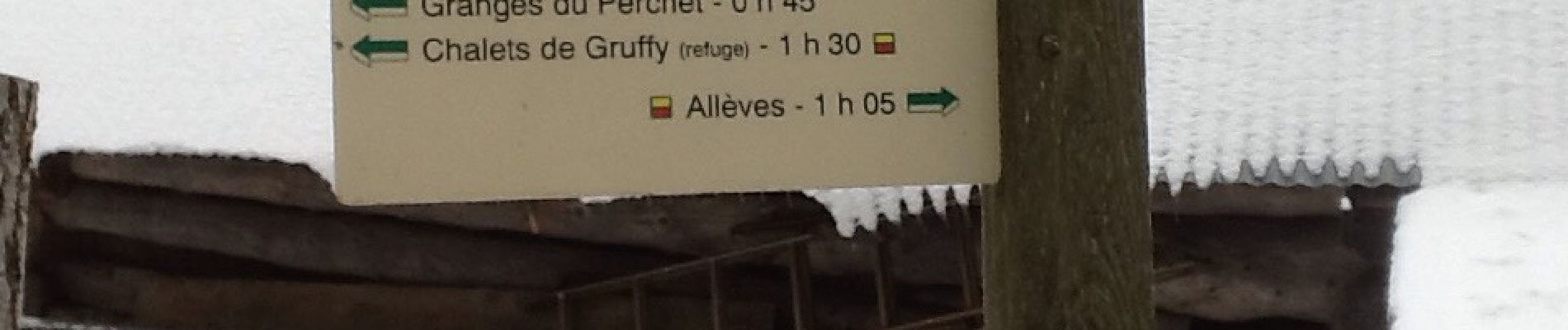
9 janvier 2017.
Temps brouillard et froid.
Photos


Positioning
Country:
France
Region :
Auvergne-Rhône-Alpes
Department/Province :
Upper Savoy
Municipality :
Allèves
Location:
Unknown
Start:(Dec)
Start:(UTM)
272924 ; 5070645 (32T) N.
Comments