Trail Walking Lagorce - leyris - Photo
 JDEL84
JDEL84

User

© OpenStreetMap contributors
Length
Length
15.4 km
Max alt
Max alt
375 m
Uphill gradient
Uphill gradient
447 m
Km-Effort
Km-Effort  
21 km
Min alt
Min alt
131 m
Downhill gradient
Downhill gradient
447 m
Boucle
Boucle
Yes
Creation date :
2017-01-12 00:00:00.0
Updated on :
2017-01-12 00:00:00.0

(0 Reviews)

Walking
Walking
4h31
Difficulty : Medium

Scan this QR Code to open this trail in the SityTrail application

FREE GPS app for hiking

Logo SityTrail SityTrail

IGN / Geographical institutes

Download SityTrail from the App Store Download SityTrail from Google Play

Logo SityTrail SityTrail World

The world is yours!

Download SityTrail from the App Store Download SityTrail from Google Play Download SityTrail on Huawei AppGallery

About

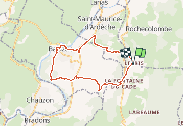
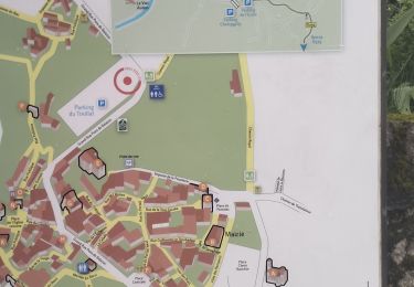
Trail Walking of 15.4 km to be discovered at Auvergne-Rhône-Alpes, Ardèche, Lagorce. This trail is proposed by JDEL84.

Description

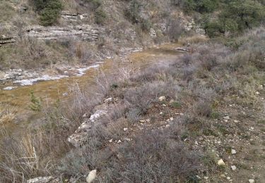
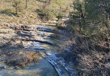
Départ de Leyris et descente vers l'Ardèche avec un léger dénivellé au milieu de vignobles.
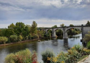
Nous empruntons une ancienne ligne de chemin de fer avec passage sur un viaduc. Traversée de la D579
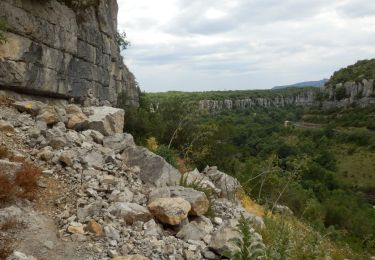
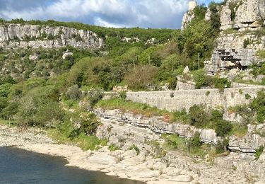
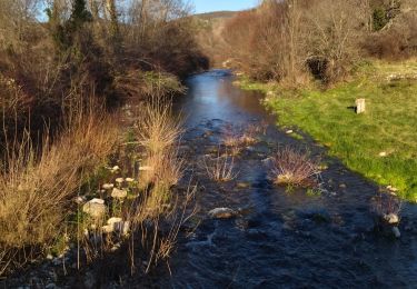
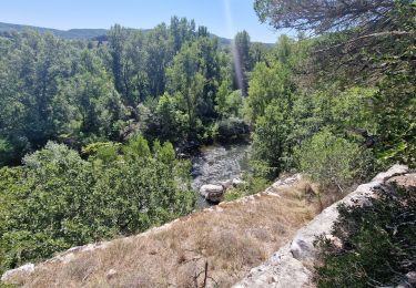
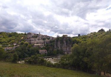
Nous apercevons l'Ardèche et Balazuc que nous traverseront.
Nous nous dirigeons vers le Sud pendant 1 km, et remontons vers Leyrus.

Elevation profile

Photos

Positioning

Country:
France
Region :
Auvergne-Rhône-Alpes
Department/Province :
Ardèche
Municipality :
Lagorce
Location:
Unknown
Start:(UTM)
613059 ; 4928570 (31T) N.

Trails nearby

Trail Walking Vogüé - Vogue Gare Lanas 7km5 - Photo
Walking
chancha

Walking

Easy
(1)
Vogüé, Auvergne-Rhône-Alpes, Ardèche, France
7.4 km | 8.8 km-effort
2h 3min
Yes
Trail Walking Pradons - Pradons Gens Abeille 18km - Photo
Walking
GUIDE
thonyc

Walking

Difficult
Pradons, Auvergne-Rhône-Alpes, Ardèche, France
18.9 km | 26 km-effort
5h 50min
Yes
Trail sport Balazuc - Balazuc la tour de Jeanne le Viel Audon  - Photo
sport
alinetpierre

sport

Very easy
Balazuc, Auvergne-Rhône-Alpes, Ardèche, France
8.5 km | 12.3 km-effort
Unknown
Yes
Trail Walking Balazuc - 07_balazuc_5km210m - Photo
Walking
SyMA

Walking

Easy
Balazuc, Auvergne-Rhône-Alpes, Ardèche, France
5.2 km | 8 km-effort
1h 45min
Yes
Trail Walking Rochecolombe - 07 rochecompmbe gour sompe - Photo
Walking
himba26100

Walking

Medium
Rochecolombe, Auvergne-Rhône-Alpes, Ardèche, France
17 km | 23 km-effort
6h 22min
Yes
Trail Walking Saint-Maurice-d'Ibie - 07 st Maurice d ibis a revoir - Photo
Walking
himba26100

Walking

Medium
Saint-Maurice-d'Ibie, Auvergne-Rhône-Alpes, Ardèche, France
14.9 km | 21 km-effort
5h 24min
No
Trail Walking Lanas - Lanas- Boucle vers Balazuc - Photo
Walking
tbrunet

Walking

Medium
Lanas, Auvergne-Rhône-Alpes, Ardèche, France
6.6 km | 8.4 km-effort
2h 36min
Yes
Trail Walking Chauzon - camping le coin charmant Chauzon à Balazuc - Photo
Walking
nadd73

Walking

Medium
Chauzon, Auvergne-Rhône-Alpes, Ardèche, France
13.4 km | 19.2 km-effort
3h 8min
Yes
Trail Walking Balazuc - Les crêtes du grand travers Balazuc - Photo
Walking
GUIDE
Roger Philippe Wallez

Walking

Very difficult
Balazuc, Auvergne-Rhône-Alpes, Ardèche, France
16.4 km | 22 km-effort
5h 18min
Yes


Close
My subscriptions