


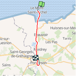
Basse Normandie - Ligne 00H - Pontorson - Mont-Saint-Michel

mich54
User


5m
Difficulty : Unknown

FREE GPS app for hiking
 SityTrail
IGN / Geographical institutes
SityTrail Plus
The world is yours!
About
Trail Other activity of 10.2 km to be discovered at Normandy, Manche, Pontorson. This trail is proposed by mich54.
Description
La ligne de Pontorson au Mont-Saint-Michel est une ancienne ligne de chemin de fer française longue de dix kilomètres, située dans le département de la Manche (Basse-Normandie).
À vocation touristique, elle est exploitée par deux compagnies successives entre 1901 et 1938.(Source Wikipédia)
Positioning
Comments