


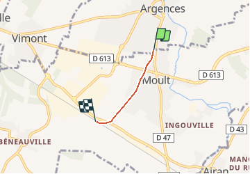
Basse Normandie - Ligne 00I - Moult - Argences

mich54
User

Length
1.8 km

Max alt
37 m

Uphill gradient
15 m
Km-Effort
2 km

Min alt
23 m

Downhill gradient
3 m
Boucle
No
Creation date :
2017-01-23 00:00:00.0
Updated on :
2017-01-23 00:00:00.0
5m
Difficulty : Unknown

FREE GPS app for hiking
 SityTrail
IGN / Geographical institutes
SityTrail Plus
The world is yours!
About
Trail Other activity of 1.8 km to be discovered at Normandy, Calvados, Argences. This trail is proposed by mich54.
Description
La gare de Moult - Argences est une halte ferroviaire française située sur la commune de Moult à proximité d'Argences dans le département du Calvados en région Basse-Normandie.(Source Wikipédia)
Positioning
Country:
France
Region :
Normandy
Department/Province :
Calvados
Municipality :
Argences
Location:
Unknown
Start:(Dec)
Start:(UTM)
706743 ; 5444691 (30U) N.
Comments