


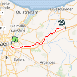
Basse Normandie - Ligne 380 - Caen - Dozulé-Putot

mich54
User


5m
Difficulty : Unknown

FREE GPS app for hiking
 SityTrail
IGN / Geographical institutes
SityTrail Plus
The world is yours!
About
Trail Other activity of 22 km to be discovered at Normandy, Calvados, Caen. This trail is proposed by mich54.
Description
La ligne de Caen à Dozulé-Putot est une ancienne ligne du réseau ferré français ouverte en 1881 pour relier Caen à la ligne de Mézidon à Trouville - Deauville et ainsi offrir un accès plus direct aux stations balnéaires de la côte Fleurie. Le trafic a cessé en plusieurs étapes et la ligne a ensuite été déclassée et déferrée.
Vestiges
L'emprise ferroviaire a été sauvegardée sur une grande partie du territoire de Mondeville. On y retrouve deux maisons de garde-barrière sur la route de Cabourg et sur la rue de la Cavée. Entre la route de Cabourg et le boulevard périphérique de Caen, l'ancienne plateforme, acquise par la commune en 2002, a été transformée en voie verte.(Source Wikipédia)
Positioning
Comments