


Ratti (pointe du)

Patricelecerf
User
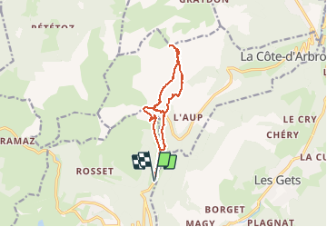

Length
11.8 km

Max alt
1902 m

Uphill gradient
767 m
Km-Effort
22 km

Min alt
1187 m

Downhill gradient
765 m
Boucle
Yes
Creation date :
2017-02-18 00:00:00.0
Updated on :
2017-02-18 00:00:00.0
5h38
Difficulty : Easy

FREE GPS app for hiking
 SityTrail
IGN / Geographical institutes
SityTrail Plus
The world is yours!
About
Trail Snowshoes of 11.8 km to be discovered at Auvergne-Rhône-Alpes, Upper Savoy, Taninges. This trail is proposed by Patricelecerf.
Description
22/01/16
Positioning
Country:
France
Region :
Auvergne-Rhône-Alpes
Department/Province :
Upper Savoy
Municipality :
Taninges
Location:
Unknown
Start:(Dec)
Start:(UTM)
315995 ; 5114005 (32T) N.
Comments