


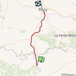
Basse Normandie - Ligne 436 - La Chapelle-Anthenaise - Flers

mich54
User


5m
Difficulty : Unknown

FREE GPS app for hiking
 SityTrail
IGN / Geographical institutes
SityTrail Plus
The world is yours!
About
Trail Other activity of 45 km to be discovered at Pays de la Loire, Mayenne, Ambrières-les-Vallées. This trail is proposed by mich54.
Description
La ligne de La Chapelle-Anthenaise à Flers est une ancienne ligne du réseau ferré national français, qui traversait les départements de l'Orne et de la Mayenne. C'était un élément de la ligne Caen - Laval, relation commerciale reliant entre elles les villes de Caen et Laval par Flers.(Source Wikipédia)
Section de Ambrières à Flers.
Positioning
Comments