


20170122

fredodlageo
User
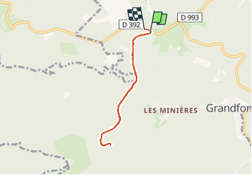

Length
5.8 km

Max alt
790 m

Uphill gradient
66 m
Km-Effort
6.7 km

Min alt
728 m

Downhill gradient
82 m
Boucle
Yes
Creation date :
2017-02-03 00:00:00.0
Updated on :
2017-02-03 00:00:00.0
1h17
Difficulty : Very easy

FREE GPS app for hiking
 SityTrail
IGN / Geographical institutes
SityTrail Plus
The world is yours!
About
Trail Winter sports of 5.8 km to be discovered at Grand Est, Bas-Rhin, Grandfontaine. This trail is proposed by fredodlageo.
Description
Skis de fond donon
Positioning
Country:
France
Region :
Grand Est
Department/Province :
Bas-Rhin
Municipality :
Grandfontaine
Location:
Unknown
Start:(Dec)
Start:(UTM)
362555 ; 5374135 (32U) N.
Comments