


habere-poche

COMAN
User
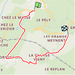

Length
3.4 km

Max alt
1162 m

Uphill gradient
254 m
Km-Effort
6.2 km

Min alt
936 m

Downhill gradient
78 m
Boucle
No
Creation date :
2017-02-13 00:00:00.0
Updated on :
2017-02-13 00:00:00.0
2h30
Difficulty : Unknown

FREE GPS app for hiking
 SityTrail
IGN / Geographical institutes
SityTrail Plus
The world is yours!
About
Trail Other activity of 3.4 km to be discovered at Auvergne-Rhône-Alpes, Upper Savoy, Habère-Poche. This trail is proposed by COMAN.
Positioning
Country:
France
Region :
Auvergne-Rhône-Alpes
Department/Province :
Upper Savoy
Municipality :
Habère-Poche
Location:
Unknown
Start:(Dec)
Start:(UTM)
305148 ; 5124469 (32T) N.
Comments