


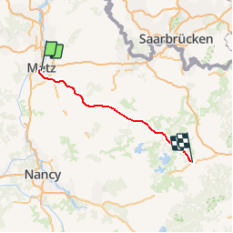
Grand Est - Ligne 140 - Metz-Ville Réding

mich54
User

Length
88 km

Max alt
271 m

Uphill gradient
614 m
Km-Effort
96 km

Min alt
166 m

Downhill gradient
537 m
Boucle
No
Creation date :
2017-03-03 00:00:00.0
Updated on :
2017-03-03 00:00:00.0
5m
Difficulty : Unknown

FREE GPS app for hiking
 SityTrail
IGN / Geographical institutes
SityTrail Plus
The world is yours!
About
Trail Other activity of 88 km to be discovered at Grand Est, Moselle, Metz. This trail is proposed by mich54.
Description
En cours de traitement
(Concept protégé INPI)
Positioning
Country:
France
Region :
Grand Est
Department/Province :
Moselle
Municipality :
Metz
Location:
Unknown
Start:(Dec)
Start:(UTM)
294100 ; 5443447 (32U) N.
Comments