


Conflans

cailloux54
User
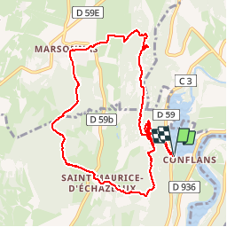

Length
10.3 km

Max alt
552 m

Uphill gradient
388 m
Km-Effort
15.5 km

Min alt
293 m

Downhill gradient
388 m
Boucle
Yes
Creation date :
2017-02-19 00:00:00.0
Updated on :
2017-02-19 00:00:00.0
3h26
Difficulty : Medium

FREE GPS app for hiking
 SityTrail
IGN / Geographical institutes
SityTrail Plus
The world is yours!
About
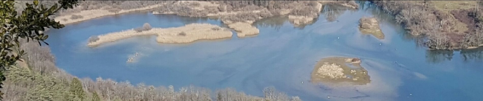
Trail Walking of 10.3 km to be discovered at Auvergne-Rhône-Alpes, Ain, Corveissiat. This trail is proposed by cailloux54.
Photos


Positioning
Country:
France
Region :
Auvergne-Rhône-Alpes
Department/Province :
Ain
Municipality :
Corveissiat
Location:
Unknown
Start:(Dec)
Start:(UTM)
693017 ; 5126209 (31T) N.
Comments