


Montpezat

coulombf
User

Length
16.4 km

Max alt
199 m

Uphill gradient
319 m
Km-Effort
21 km

Min alt
83 m

Downhill gradient
315 m
Boucle
Yes
Creation date :
2017-05-23 00:00:00.0
Updated on :
2017-05-23 00:00:00.0
4h30
Difficulty : Easy

FREE GPS app for hiking
 SityTrail
IGN / Geographical institutes
SityTrail Plus
The world is yours!
About
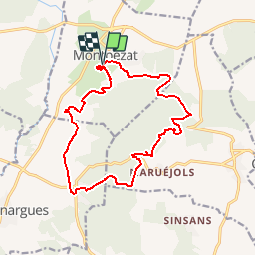
Trail Walking of 16.4 km to be discovered at Occitania, Gard, Montpezat. This trail is proposed by coulombf.
Positioning
Country:
France
Region :
Occitania
Department/Province :
Gard
Municipality :
Montpezat
Location:
Unknown
Start:(Dec)
Start:(UTM)
593033 ; 4855960 (31T) N.
Comments
pas terrible...
Très belle rando.