


100 km dans le Jura

cailloux54
User
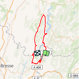

Length
97 km

Max alt
694 m

Uphill gradient
1749 m
Km-Effort
120 km

Min alt
284 m

Downhill gradient
1748 m
Boucle
Yes
Creation date :
2017-03-17 00:00:00.0
Updated on :
2017-03-17 00:00:00.0
6h43
Difficulty : Difficult

FREE GPS app for hiking
 SityTrail
IGN / Geographical institutes
SityTrail Plus
The world is yours!
About
Trail Cycle of 97 km to be discovered at Auvergne-Rhône-Alpes, Ain, Bellignat. This trail is proposed by cailloux54.

Positioning
Country:
France
Region :
Auvergne-Rhône-Alpes
Department/Province :
Ain
Municipality :
Bellignat
Location:
Unknown
Start:(Dec)
Start:(UTM)
702309 ; 5124096 (31T) N.
Comments