


grillon

jpfrobert
User

Length
56 km

Max alt
398 m

Uphill gradient
828 m
Km-Effort
67 km

Min alt
97 m

Downhill gradient
829 m
Boucle
Yes
Creation date :
2017-03-25 00:00:00.0
Updated on :
2017-03-25 00:00:00.0
3h49
Difficulty : Medium

FREE GPS app for hiking
 SityTrail
IGN / Geographical institutes
SityTrail Plus
The world is yours!
About
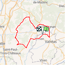
Trail Cycle of 56 km to be discovered at Provence-Alpes-Côte d'Azur, Vaucluse, Grillon. This trail is proposed by jpfrobert.
Positioning
Country:
France
Region :
Provence-Alpes-Côte d'Azur
Department/Province :
Vaucluse
Municipality :
Grillon
Location:
Unknown
Start:(Dec)
Start:(UTM)
654978 ; 4919447 (31T) N.
Comments