


beaumont en auge 26032017

Laurent53
User

Length
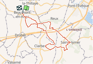
19.4 km

Max alt
127 m

Uphill gradient
365 m
Km-Effort
24 km

Min alt
34 m

Downhill gradient
366 m
Boucle
Yes
Creation date :
2017-03-27 00:00:00.0
Updated on :
2017-03-27 00:00:00.0
5h12
Difficulty : Easy

FREE GPS app for hiking
 SityTrail
IGN / Geographical institutes
SityTrail Plus
The world is yours!
About
Trail Walking of 19.4 km to be discovered at Normandy, Calvados, Beaumont-en-Auge. This trail is proposed by Laurent53.
Description
Le chemin est gras quand il a plu, surtout dans les vallées. ( Bâtons conseillés dans les parties difficiles)
Photos


Positioning
Country:
France
Region :
Normandy
Department/Province :
Calvados
Municipality :
Beaumont-en-Auge
Location:
Unknown
Start:(Dec)
Start:(UTM)
289822 ; 5462450 (31U) N.
Comments