


léomont

babouille
User
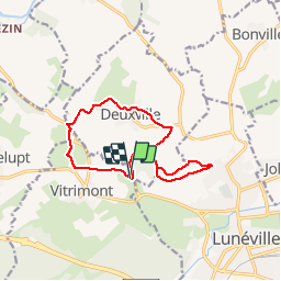

Length
11.4 km

Max alt
332 m

Uphill gradient
209 m
Km-Effort
14.2 km

Min alt
240 m

Downhill gradient
207 m
Boucle
Yes
Creation date :
2017-03-31 00:00:00.0
Updated on :
2017-03-31 00:00:00.0
1h26
Difficulty : Easy

FREE GPS app for hiking
 SityTrail
IGN / Geographical institutes
SityTrail Plus
The world is yours!
About
Trail Running of 11.4 km to be discovered at Grand Est, Meurthe-et-Moselle, Vitrimont. This trail is proposed by babouille.
Description
Sortie Trail


Positioning
Country:
France
Region :
Grand Est
Department/Province :
Meurthe-et-Moselle
Municipality :
Vitrimont
Location:
Unknown
Start:(Dec)
Start:(UTM)
312423 ; 5386593 (32U) N.
Comments