


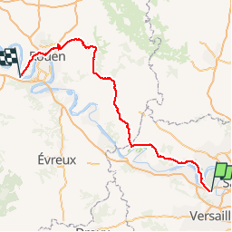
Saint Germain en Laye RER vers -Rouen-la bouille via Est de Rouen

lionelwalter
User

Length
162 km

Max alt
189 m

Uphill gradient
1888 m
Km-Effort
188 km

Min alt
2 m

Downhill gradient
1969 m
Boucle
No
Creation date :
2018-04-16 00:00:00.0
Updated on :
2018-04-16 00:00:00.0
8h10
Difficulty : Easy

FREE GPS app for hiking
 SityTrail
IGN / Geographical institutes
SityTrail Plus
The world is yours!
About
Trail Cycle of 162 km to be discovered at Ile-de-France, Yvelines, Saint-Germain-en-Laye. This trail is proposed by lionelwalter.
Description
passage par l'est de Rouen via les Andelys vascoeuil bois guillaume
Positioning
Country:
France
Region :
Ile-de-France
Department/Province :
Yvelines
Municipality :
Saint-Germain-en-Laye
Location:
Saint-Germain-en-Laye
Start:(Dec)
Start:(UTM)
433690 ; 5416780 (31U) N.
Comments