


ski de Rando CARAMENTRAN

trailer.nono
User
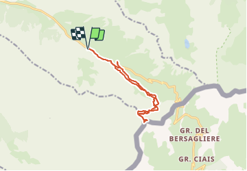

Length
12.7 km

Max alt
3007 m

Uphill gradient
852 m
Km-Effort
24 km

Min alt
2190 m

Downhill gradient
846 m
Boucle
Yes
Creation date :
2017-04-17 00:00:00.0
Updated on :
2017-04-17 00:00:00.0
2h51
Difficulty : Medium

FREE GPS app for hiking
 SityTrail
IGN / Geographical institutes
SityTrail Plus
The world is yours!
About
Trail Other activity of 12.7 km to be discovered at Provence-Alpes-Côte d'Azur, Hautes-Alpes, Molines-en-Queyras. This trail is proposed by trailer.nono.
Positioning
Country:
France
Region :
Provence-Alpes-Côte d'Azur
Department/Province :
Hautes-Alpes
Municipality :
Molines-en-Queyras
Location:
Unknown
Start:(Dec)
Start:(UTM)
336350 ; 4952094 (32T) N.
Comments