


Rouen Bis

doudet
User
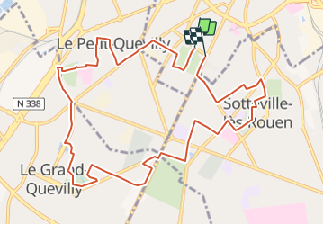

Length
11.5 km

Max alt
60 m

Uphill gradient
105 m
Km-Effort
12.9 km

Min alt
8 m

Downhill gradient
107 m
Boucle
Yes
Creation date :
2018-09-11 09:11:05.358
Updated on :
2018-09-11 09:11:05.358
3h00
Difficulty : Unknown

FREE GPS app for hiking
 SityTrail
IGN / Geographical institutes
SityTrail Plus
The world is yours!
About
Trail Other activity of 11.5 km to be discovered at Normandy, Seine-Maritime, Rouen. This trail is proposed by doudet.
Positioning
Country:
France
Region :
Normandy
Department/Province :
Seine-Maritime
Municipality :
Rouen
Location:
Unknown
Start:(Dec)
Start:(UTM)
360606 ; 5476285 (31U) N.
Comments