Trail Walking Fontainebleau - 170426 - GLM-RetourCrêtesRCleaude - Photo

170426 - GLM-RetourCrêtesRCleaude

 randodan
randodan

User

© OpenStreetMap contributors
Length
Length
6.3 km
Max alt
Max alt
113 m
Uphill gradient
Uphill gradient
47 m
Km-Effort
Km-Effort  
6.9 km
Min alt
Min alt
83 m
Downhill gradient
Downhill gradient
60 m
Boucle
Boucle
No
Creation date :
2017-05-12 00:00:00.0
Updated on :
2017-05-12 00:00:00.0

(0 Reviews)

Walking
Walking
1h33
Difficulty : Easy

Scan this QR Code to open this trail in the SityTrail application

FREE GPS app for hiking

Logo SityTrail SityTrail

IGN / Geographical institutes

Download SityTrail from the App Store Download SityTrail from Google Play

Logo SityTrail SityTrail Plus

The world is yours!

Download SityTrail from the App Store Download SityTrail from Google Play Download SityTrail on Huawei AppGallery

About

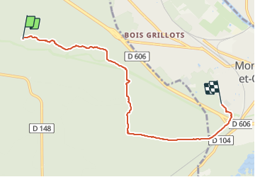
Trail Walking of 6.3 km to be discovered at Ile-de-France, Seine-et-Marne, Fontainebleau. This trail is proposed by randodan.

Description

- Mercredi 26 avril 2017 -<br>
Quelques "premières" pour ce mercredi matin : aller classique à la Roche A Cleaude (Médicis jusqu'à l'Hallali), retour par les crêtes avec un max de hors piste (on en profite qu'on n'est que 2) . Cette nouveauté m'incite à enregistrer la trace.<br>
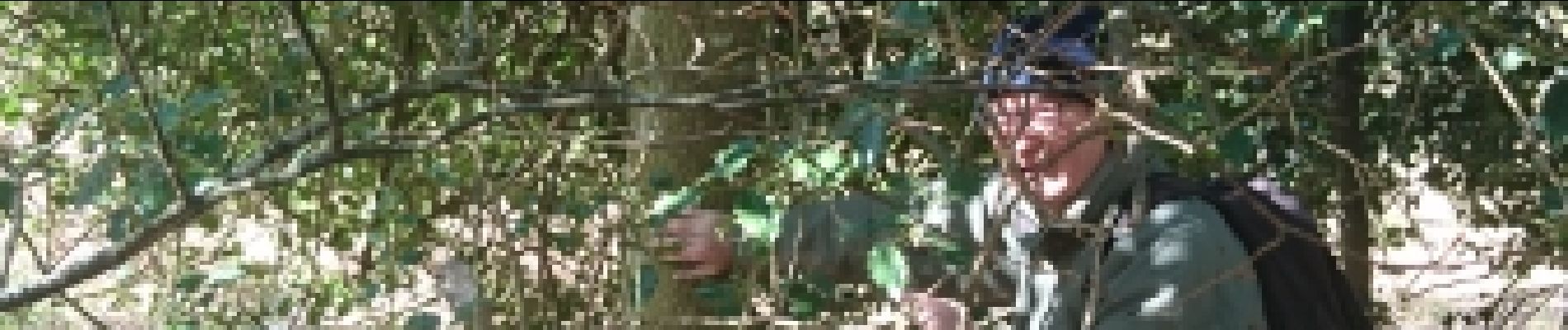
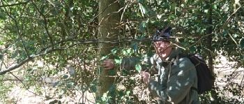
Au cours du hors piste, 30 m avant la Route de la Meute, un houx au tronc impressionnant. Mais après fouille sur le net, il en existe de bien   gros (2,67 m de circonférence pour le <a href="http://lestetardsarboricoles.fr/wordpress/2013/06/10/le-gros-houx-du-chateau-de-lassay-les-chateaux" TARGET="_blank">Houx du Château de Lassay-les-Châteaux</a>.

Elevation profile

Photos

Points of interest

Point of interest Fontainebleau - 01 - Houx-là-là ! Quel gros tronc il a ! - Photo
randodan

Positioning

Country:
France
Region :
Ile-de-France
Department/Province :
Seine-et-Marne
Municipality :
Fontainebleau
Location:
Unknown
Start:(UTM)
481994 ; 5358383 (31U) N.


Close
My subscriptions