


aubazine par chemin des moines

dadodeca
User

Length
10.7 km

Max alt
515 m

Uphill gradient
363 m
Km-Effort
15.5 km

Min alt
242 m

Downhill gradient
361 m
Boucle
Yes
Creation date :
2017-04-29 00:00:00.0
Updated on :
2017-04-29 00:00:00.0
2h58
Difficulty : Medium

FREE GPS app for hiking
 SityTrail
IGN / Geographical institutes
SityTrail Plus
The world is yours!
About
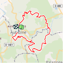
Trail Walking of 10.7 km to be discovered at New Aquitaine, Corrèze, Aubazines. This trail is proposed by dadodeca.
Positioning
Country:
France
Region :
New Aquitaine
Department/Province :
Corrèze
Municipality :
Aubazines
Location:
Unknown
Start:(Dec)
Start:(UTM)
395485 ; 5003155 (31T) N.
Comments