


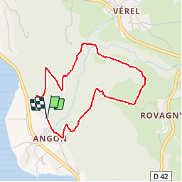
Cascade d'Angon - Petit Tour

gregou74
User

Length
3.7 km

Max alt
767 m

Uphill gradient
299 m
Km-Effort
7.7 km

Min alt
465 m

Downhill gradient
303 m
Boucle
Yes
Creation date :
2019-04-27 13:17:11.883
Updated on :
2019-04-27 13:17:11.917
1h34
Difficulty : Easy

FREE GPS app for hiking
 SityTrail
IGN / Geographical institutes
SityTrail Plus
The world is yours!
About
Trail Walking of 3.7 km to be discovered at Auvergne-Rhône-Alpes, Upper Savoy, Talloires-Montmin. This trail is proposed by gregou74.
Positioning
Country:
France
Region :
Auvergne-Rhône-Alpes
Department/Province :
Upper Savoy
Municipality :
Talloires-Montmin
Location:
Talloires
Start:(Dec)
Start:(UTM)
284332 ; 5078691 (32T) N.
Comments