


pas de clapier par le barrage de bimont

Coryphene
User
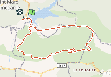

Length
11.8 km

Max alt
676 m

Uphill gradient
529 m
Km-Effort
18.8 km

Min alt
268 m

Downhill gradient
517 m
Boucle
Yes
Creation date :
2017-04-30 00:00:00.0
Updated on :
2017-04-30 00:00:00.0
3h02
Difficulty : Medium

FREE GPS app for hiking
 SityTrail
IGN / Geographical institutes
SityTrail Plus
The world is yours!
About
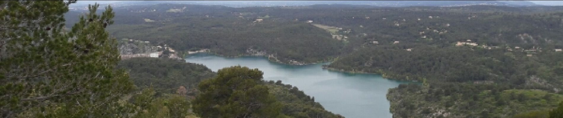
Trail Walking of 11.8 km to be discovered at Provence-Alpes-Côte d'Azur, Bouches-du-Rhône, Saint-Marc-Jaumegarde. This trail is proposed by Coryphene.
Photos

Positioning
Country:
France
Region :
Provence-Alpes-Côte d'Azur
Department/Province :
Bouches-du-Rhône
Municipality :
Saint-Marc-Jaumegarde
Location:
Unknown
Start:(Dec)
Start:(UTM)
704746 ; 4824060 (31T) N.
Comments