


GR121B Phalempin à Ennevelin

dehemjacques
User
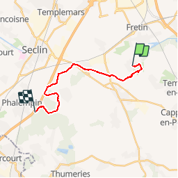

Length
14.4 km

Max alt
63 m

Uphill gradient
94 m
Km-Effort
15.6 km

Min alt
26 m

Downhill gradient
73 m
Boucle
No
Creation date :
2017-05-05 00:00:00.0
Updated on :
2017-05-05 00:00:00.0
3h28
Difficulty : Easy

FREE GPS app for hiking
 SityTrail
IGN / Geographical institutes
SityTrail Plus
The world is yours!
About
Trail Walking of 14.4 km to be discovered at Hauts-de-France, Nord, Ennevelin. This trail is proposed by dehemjacques.
Positioning
Country:
France
Region :
Hauts-de-France
Department/Province :
Nord
Municipality :
Ennevelin
Location:
Unknown
Start:(Dec)
Start:(UTM)
509059 ; 5598708 (31U) N.
Comments
très agreable par rapport à l'ancien tracé