


FFBMP Dinant

fra_depoorter
User
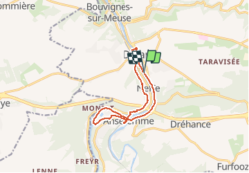

Length
10.9 km

Max alt
141 m

Uphill gradient
166 m
Km-Effort
13.1 km

Min alt
78 m

Downhill gradient
168 m
Boucle
Yes
Creation date :
2017-05-13 00:00:00.0
Updated on :
2017-05-13 00:00:00.0
2h15
Difficulty : Unknown

FREE GPS app for hiking
 SityTrail
IGN / Geographical institutes
SityTrail Plus
The world is yours!
About
Trail Walking of 10.9 km to be discovered at Wallonia, Namur, Dinant. This trail is proposed by fra_depoorter.
Positioning
Country:
Belgium
Region :
Wallonia
Department/Province :
Namur
Municipality :
Dinant
Location:
Dinant
Start:(Dec)
Start:(UTM)
636563 ; 5568550 (31U) N.
Comments