


yyyyoooi

Pousscailleux
User
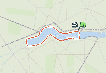

Length
2.9 km

Max alt
61 m

Uphill gradient
26 m
Km-Effort
3.3 km

Min alt
45 m

Downhill gradient
28 m
Boucle
Yes
Creation date :
2017-05-22 00:00:00.0
Updated on :
2022-11-28 11:03:29.103
1h00
Difficulty : Easy

FREE GPS app for hiking
 SityTrail
IGN / Geographical institutes
SityTrail Plus
The world is yours!
About
Trail On foot of 2.9 km to be discovered at Hauts-de-France, Oise, Coye-la-Forêt. This trail is proposed by Pousscailleux.
Description
Départ du parking entre l'étang Neuf et l'étang Chaperon.
Positioning
Country:
France
Region :
Hauts-de-France
Department/Province :
Oise
Municipality :
Coye-la-Forêt
Location:
Unknown
Start:(Dec)
Start:(UTM)
463142 ; 5445156 (31U) N.
Comments