


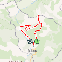
rabou au pic de melette

Didier.kiehl
User

Length
15.1 km

Max alt
2042 m

Uphill gradient
1153 m
Km-Effort
31 km

Min alt
1151 m

Downhill gradient
1152 m
Boucle
Yes
Creation date :
2017-05-24 00:00:00.0
Updated on :
2017-05-24 00:00:00.0
5h33
Difficulty : Difficult

FREE GPS app for hiking
 SityTrail
IGN / Geographical institutes
SityTrail Plus
The world is yours!
About
Trail Walking of 15.1 km to be discovered at Provence-Alpes-Côte d'Azur, Hautes-Alpes, Rabou. This trail is proposed by Didier.kiehl.
Description
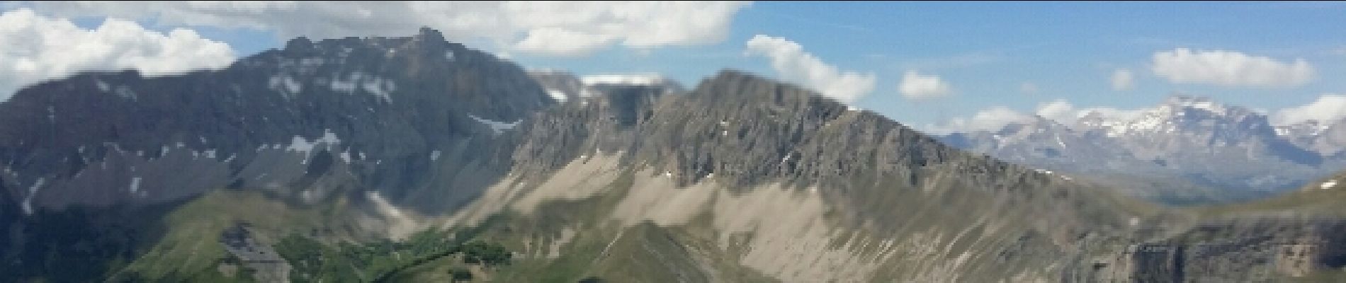
Très belle randonnée avec des paysages génial ne pas avoir le vertige sur chemin des ban
Photos


Positioning
Country:
France
Region :
Provence-Alpes-Côte d'Azur
Department/Province :
Hautes-Alpes
Municipality :
Rabou
Location:
Unknown
Start:(Dec)
Start:(UTM)
262422 ; 4942244 (32T) N.
Comments