


les en-cas aux infernets

Coryphene
User
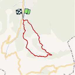

Length
6.3 km

Max alt
534 m

Uphill gradient
311 m
Km-Effort
10.4 km

Min alt
244 m

Downhill gradient
311 m
Boucle
Yes
Creation date :
2017-05-25 00:00:00.0
Updated on :
2019-09-24 15:18:07.653
2h20
Difficulty : Easy

FREE GPS app for hiking
 SityTrail
IGN / Geographical institutes
SityTrail Plus
The world is yours!
About
Trail Walking of 6.3 km to be discovered at Provence-Alpes-Côte d'Azur, Bouches-du-Rhône, Auriol. This trail is proposed by Coryphene.
Photos


Positioning
Country:
France
Region :
Provence-Alpes-Côte d'Azur
Department/Province :
Bouches-du-Rhône
Municipality :
Auriol
Location:
Unknown
Start:(Dec)
Start:(UTM)
715603 ; 4803197 (31T) N.
Comments