


11-Mayronnes-Serre Pène-05-06-2017

Jovila
User

Length
13.9 km

Max alt
659 m

Uphill gradient
675 m
Km-Effort
23 km

Min alt
238 m

Downhill gradient
675 m
Boucle
Yes
Creation date :
2017-06-06 00:00:00.0
Updated on :
2017-06-06 00:00:00.0
5h40
Difficulty : Medium

FREE GPS app for hiking
 SityTrail
IGN / Geographical institutes
SityTrail Plus
The world is yours!
About
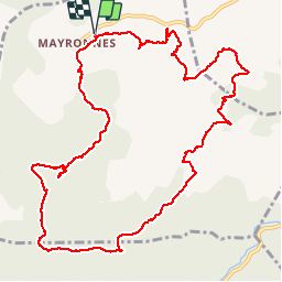
Trail Walking of 13.9 km to be discovered at Occitania, Aude, Mayronnes. This trail is proposed by Jovila.
Description
Très belle randonnée avec de très beaux points de vues et chemins en forêt.
Se garer sur le parking à gauche avant l'entrée du village.
Prendre la direction du sentier sculturel et suivre le balisage jaune.
Positioning
Country:
France
Region :
Occitania
Department/Province :
Aude
Municipality :
Mayronnes
Location:
Unknown
Start:(Dec)
Start:(UTM)
461622 ; 4767322 (31T) N.
Comments