


dome des Picheres

whisper73
User

Length
17.3 km

Max alt
3303 m

Uphill gradient
1788 m
Km-Effort
43 km

Min alt
1559 m

Downhill gradient
2402 m
Boucle
No
Creation date :
2017-06-11 00:00:00.0
Updated on :
2019-08-04 19:21:49.933
5h20
Difficulty : Difficult
20m
Difficulty : Easy

FREE GPS app for hiking
 SityTrail
IGN / Geographical institutes
SityTrail Plus
The world is yours!
About
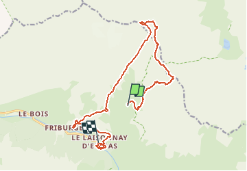
Trail Walking of 17.3 km to be discovered at Auvergne-Rhône-Alpes, Savoy, Champagny-en-Vanoise. This trail is proposed by whisper73.
Positioning
Country:
France
Region :
Auvergne-Rhône-Alpes
Department/Province :
Savoy
Municipality :
Champagny-en-Vanoise
Location:
Unknown
Start:(Dec)
Start:(UTM)
327366 ; 5036747 (32T) N.
Comments