


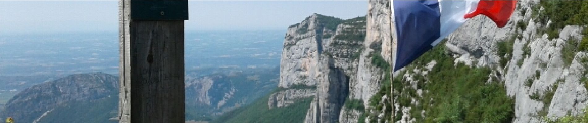
CHATELUS-le 18-06-2017

okfred26
User
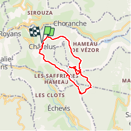

Length
13.5 km

Max alt
1259 m

Uphill gradient
1078 m
Km-Effort
28 km

Min alt
529 m

Downhill gradient
1078 m
Boucle
Yes
Creation date :
2017-06-20 00:00:00.0
Updated on :
2017-06-20 00:00:00.0
7h09
Difficulty : Medium

FREE GPS app for hiking
 SityTrail
IGN / Geographical institutes
SityTrail Plus
The world is yours!
About
Trail Walking of 13.5 km to be discovered at Auvergne-Rhône-Alpes, Isère, Châtelus. This trail is proposed by okfred26.
Photos


Positioning
Country:
France
Region :
Auvergne-Rhône-Alpes
Department/Province :
Isère
Municipality :
Châtelus
Location:
Unknown
Start:(Dec)
Start:(UTM)
686863 ; 4992096 (31T) N.
Comments