


200617_18_3

d.rognon
User
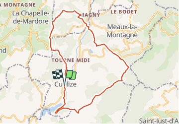

Length
18.3 km

Max alt
750 m

Uphill gradient
633 m
Km-Effort
27 km

Min alt
438 m

Downhill gradient
633 m
Boucle
Yes
Creation date :
2017-06-25 00:00:00.0
Updated on :
2017-06-25 00:00:00.0
5h21
Difficulty : Unknown

FREE GPS app for hiking
 SityTrail
IGN / Geographical institutes
SityTrail Plus
The world is yours!
About
Trail Walking of 18.3 km to be discovered at Auvergne-Rhône-Alpes, Rhône, Cublize. This trail is proposed by d.rognon.
Positioning
Country:
France
Region :
Auvergne-Rhône-Alpes
Department/Province :
Rhône
Municipality :
Cublize
Location:
Unknown
Start:(Dec)
Start:(UTM)
606697 ; 5096968 (31T) N.
Comments