


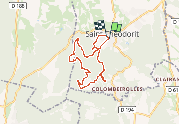
Saint THeodorit

jpfrobert
User

Length
14.6 km

Max alt
229 m

Uphill gradient
443 m
Km-Effort
20 km

Min alt
140 m

Downhill gradient
443 m
Boucle
Yes
Creation date :
2017-06-27 00:00:00.0
Updated on :
2017-06-27 00:00:00.0
1h19
Difficulty : Easy

FREE GPS app for hiking
 SityTrail
IGN / Geographical institutes
SityTrail Plus
The world is yours!
About
Trail Mountain bike of 14.6 km to be discovered at Occitania, Gard, Saint-Théodorit. This trail is proposed by jpfrobert.
Positioning
Country:
France
Region :
Occitania
Department/Province :
Gard
Municipality :
Saint-Théodorit
Location:
Unknown
Start:(Dec)
Start:(UTM)
586779 ; 4865916 (31T) N.
Comments