


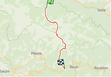
GR5 2018 7- Roya -Les LAUNES

pierrol
User

Length
18.1 km

Max alt
2590 m

Uphill gradient
1182 m
Km-Effort
34 km

Min alt
1468 m

Downhill gradient
1138 m
Boucle
No
Creation date :
2017-10-11 00:00:00.0
Updated on :
2017-10-11 00:00:00.0
6h48
Difficulty : Unknown

FREE GPS app for hiking
 SityTrail
IGN / Geographical institutes
SityTrail Plus
The world is yours!
About
Trail Walking of 18.1 km to be discovered at Provence-Alpes-Côte d'Azur, Maritime Alps, Saint-Étienne-de-Tinée. This trail is proposed by pierrol.
Positioning
Country:
France
Region :
Provence-Alpes-Côte d'Azur
Department/Province :
Maritime Alps
Municipality :
Saint-Étienne-de-Tinée
Location:
Unknown
Start:(Dec)
Start:(UTM)
334482 ; 4894965 (32T) N.
Comments