


Col de Rousset

morganee
User
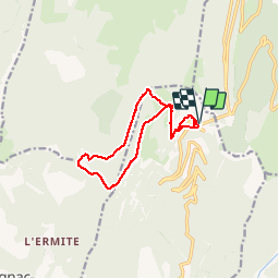

Length
12.5 km

Max alt
1544 m

Uphill gradient
600 m
Km-Effort
20 km

Min alt
1148 m

Downhill gradient
601 m
Boucle
Yes
Creation date :
2019-07-19 19:05:56.546
Updated on :
2019-07-19 19:05:56.661
3h17
Difficulty : Easy

FREE GPS app for hiking
 SityTrail
IGN / Geographical institutes
SityTrail Plus
The world is yours!
About
Trail Walking of 12.5 km to be discovered at Auvergne-Rhône-Alpes, Drôme, Chamaloc. This trail is proposed by morganee.
Positioning
Country:
France
Region :
Auvergne-Rhône-Alpes
Department/Province :
Drôme
Municipality :
Chamaloc
Location:
Unknown
Start:(Dec)
Start:(UTM)
689409 ; 4967777 (31T) N.
Comments