


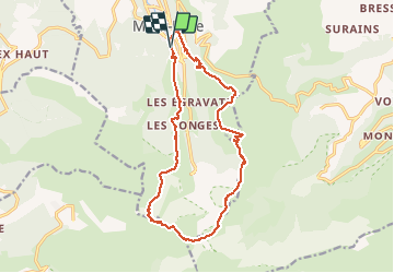
crêtes Mt Dore

jean-charlesSIMAND
User

Length
17 km

Max alt
1862 m

Uphill gradient
969 m
Km-Effort
30 km

Min alt
1048 m

Downhill gradient
971 m
Boucle
Yes
Creation date :
2017-07-16 00:00:00.0
Updated on :
2017-07-16 00:00:00.0
3h39
Difficulty : Medium

FREE GPS app for hiking
 SityTrail
IGN / Geographical institutes
SityTrail Plus
The world is yours!
About
Trail Running of 17 km to be discovered at Auvergne-Rhône-Alpes, Puy-de-Dôme, Mont-Dore. This trail is proposed by jean-charlesSIMAND.
Positioning
Country:
France
Region :
Auvergne-Rhône-Alpes
Department/Province :
Puy-de-Dôme
Municipality :
Mont-Dore
Location:
Unknown
Start:(Dec)
Start:(UTM)
485201 ; 5046330 (31T) N.
Comments