


FFBMP Mrllier

fra_depoorter
User
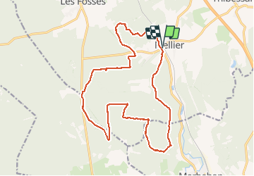

Length
18.7 km

Max alt
460 m

Uphill gradient
376 m
Km-Effort
24 km

Min alt
373 m

Downhill gradient
376 m
Boucle
Yes
Creation date :
2017-07-16 00:00:00.0
Updated on :
2017-07-16 00:00:00.0
3h59
Difficulty : Unknown

FREE GPS app for hiking
 SityTrail
IGN / Geographical institutes
SityTrail Plus
The world is yours!
About
Trail Walking of 18.7 km to be discovered at Wallonia, Luxembourg, Léglise. This trail is proposed by fra_depoorter.
Positioning
Country:
Belgium
Region :
Wallonia
Department/Province :
Luxembourg
Municipality :
Léglise
Location:
Mellier
Start:(Dec)
Start:(UTM)
681310 ; 5515653 (31U) N.
Comments