


Chard du beurre-Mont Clocher

fra_depoorter
User

Length
14.8 km

Max alt
1962 m

Uphill gradient
478 m
Km-Effort
21 km

Min alt
1657 m

Downhill gradient
479 m
Boucle
Yes
Creation date :
2017-07-16 00:00:00.0
Updated on :
2017-07-16 00:00:00.0
5h45
Difficulty : Unknown

FREE GPS app for hiking
 SityTrail
IGN / Geographical institutes
SityTrail Plus
The world is yours!
About
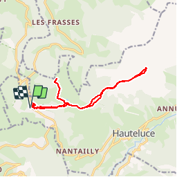
Trail Walking of 14.8 km to be discovered at Auvergne-Rhône-Alpes, Savoy, Hauteluce. This trail is proposed by fra_depoorter.
Description
Depart Les Saisies
Positioning
Country:
France
Region :
Auvergne-Rhône-Alpes
Department/Province :
Savoy
Municipality :
Hauteluce
Location:
Unknown
Start:(Dec)
Start:(UTM)
308221 ; 5070297 (32T) N.
Comments