


Carlaveyron (boucle de)

Patricelecerf
User
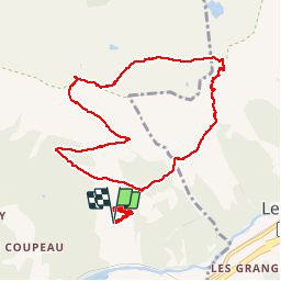

Length
11 km

Max alt
2301 m

Uphill gradient
1007 m
Km-Effort
24 km

Min alt
1352 m

Downhill gradient
1010 m
Boucle
Yes
Creation date :
2017-11-30 00:00:00.0
Updated on :
2017-11-30 00:00:00.0
7h16
Difficulty : Easy

FREE GPS app for hiking
 SityTrail
IGN / Geographical institutes
SityTrail Plus
The world is yours!
About
Trail Walking of 11 km to be discovered at Auvergne-Rhône-Alpes, Upper Savoy, Les Houches. This trail is proposed by Patricelecerf.
Description
16/07/17
Positioning
Country:
France
Region :
Auvergne-Rhône-Alpes
Department/Province :
Upper Savoy
Municipality :
Les Houches
Location:
Unknown
Start:(Dec)
Start:(UTM)
330250 ; 5085876 (32T) N.
Comments