


Canal Montalbert

ramsay
User
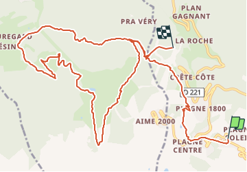

Length
15.1 km

Max alt
2059 m

Uphill gradient
410 m
Km-Effort
22 km

Min alt
1632 m

Downhill gradient
792 m
Boucle
No
Creation date :
2017-07-17 00:00:00.0
Updated on :
2017-07-17 00:00:00.0
4h42
Difficulty : Difficult

FREE GPS app for hiking
 SityTrail
IGN / Geographical institutes
SityTrail Plus
The world is yours!
About
Trail Walking of 15.1 km to be discovered at Auvergne-Rhône-Alpes, Savoy, La Plagne-Tarentaise. This trail is proposed by ramsay.
Positioning
Country:
France
Region :
Auvergne-Rhône-Alpes
Department/Province :
Savoy
Municipality :
La Plagne-Tarentaise
Location:
Mâcot-la-Plagne
Start:(Dec)
Start:(UTM)
319118 ; 5041903 (32T) N.
Comments