Forêt de Flines

BrassensJC
User
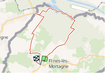

Length
8 km

Max alt
52 m

Uphill gradient
66 m
Km-Effort
8.9 km

Min alt
18 m

Downhill gradient
66 m
Boucle
Yes
Creation date :
2017-07-30 00:00:00.0
Updated on :
2017-07-30 00:00:00.0
2h00
Difficulty : Easy

FREE GPS app for hiking
 SityTrail
IGN / Geographical institutes
SityTrail Plus
The world is yours!
About
Trail Other activity of 8 km to be discovered at Hauts-de-France, Nord, Flines-lès-Mortagne. This trail is proposed by BrassensJC.
Positioning
Country:
France
Region :
Hauts-de-France
Department/Province :
Nord
Municipality :
Flines-lès-Mortagne
Location:
Unknown
Start:(Dec)
Start:(UTM)
533490 ; 5595501 (31U) N.
Comments