Trail Walking Modane - Valfréjus - col des Bataillères - Photo

Valfréjus - col des Bataillères

 suntajl
suntajl

User

© OpenStreetMap contributors
Length
Length
15.5 km
Max alt
Max alt
2778 m
Uphill gradient
Uphill gradient
892 m
Km-Effort
Km-Effort  
27 km
Min alt
Min alt
1912 m
Downhill gradient
Downhill gradient
892 m
Boucle
Boucle
Yes
Creation date :
2019-03-16 11:15:44.198
Updated on :
2019-03-16 11:15:44.241

(0 Reviews)

Walking
Walking
5h40
Difficulty : Medium

Scan this QR Code to open this trail in the SityTrail application

FREE GPS app for hiking

Logo SityTrail SityTrail

IGN / Geographical institutes

Download SityTrail from the App Store Download SityTrail from Google Play

Logo SityTrail SityTrail Plus

The world is yours!

Download SityTrail from the App Store Download SityTrail from Google Play Download SityTrail on Huawei AppGallery

About

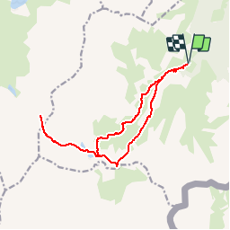
Trail Walking of 15.5 km to be discovered at Auvergne-Rhône-Alpes, Savoy, Modane. This trail is proposed by suntajl.

Description

Départ parking du Lavoir. Aller à partir de la Losa par la rive gauche du torrent,  Passage au refuge du Mont Thabor puis aux lacs Ste Marguerite. Retour par le refuge puis le Col de la Vallée Etroite et la rive droite du torrent. Posibilité de prolonger jusqu'au lac des Bataillères

Elevation profile

Positioning

Country:
France
Region :
Auvergne-Rhône-Alpes
Department/Province :
Savoy
Municipality :
Modane
Location:
Unknown
Start:(UTM)
314023 ; 5002169 (32T) N.


Close
My subscriptions