20170801 St Jaques sur Darnetal

doudet
User

Length
11.9 km

Max alt
161 m

Uphill gradient
179 m
Km-Effort
14.3 km

Min alt
47 m

Downhill gradient
179 m
Boucle
Yes
Creation date :
2018-09-11 09:10:55.394
Updated on :
2018-09-11 09:10:55.394
3h28
Difficulty : Medium

FREE GPS app for hiking
 SityTrail
IGN / Geographical institutes
SityTrail Plus
The world is yours!
About
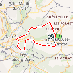
Trail Walking of 11.9 km to be discovered at Normandy, Seine-Maritime, Saint-Jacques-sur-Darnétal. This trail is proposed by doudet.
Description
Boucle A-R au départ de l'eglise de st jacques
Positioning
Country:
France
Region :
Normandy
Department/Province :
Seine-Maritime
Municipality :
Saint-Jacques-sur-Darnétal
Location:
Unknown
Start:(Dec)
Start:(UTM)
369673 ; 5477913 (31U) N.
Comments