


St Simèon la chapelle St Frimint

Laurent53
User
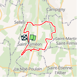

Length
11.6 km

Max alt
142 m

Uphill gradient
219 m
Km-Effort
14.5 km

Min alt
68 m

Downhill gradient
218 m
Boucle
Yes
Creation date :
2017-08-01 00:00:00.0
Updated on :
2018-07-20 12:31:41.133
3h08
Difficulty : Difficult

FREE GPS app for hiking
 SityTrail
IGN / Geographical institutes
SityTrail Plus
The world is yours!
About
Trail Walking of 11.6 km to be discovered at Normandy, Eure, Saint-Siméon. This trail is proposed by Laurent53.
Description
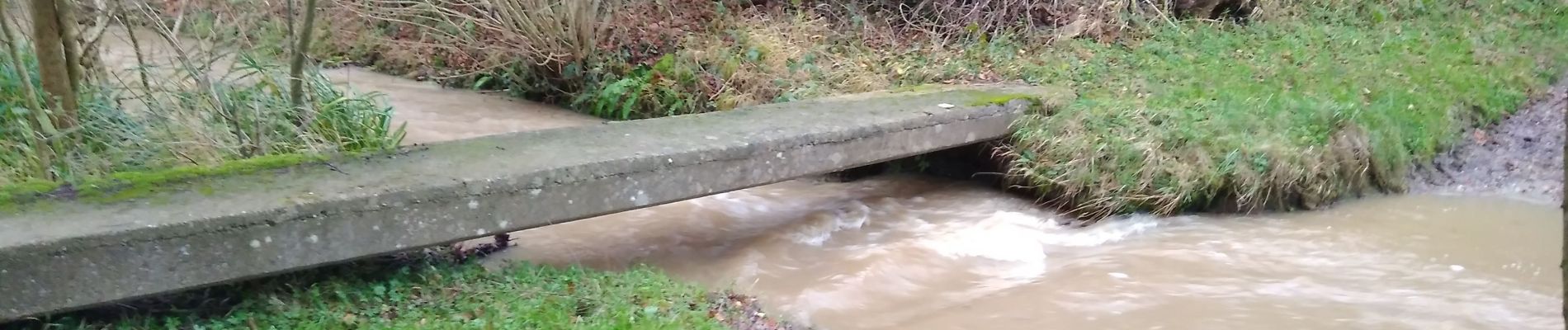
Attention plusieurs gués! pas toujours praticable en cas de forte pluies! sinon très agréable.
Une petite montée ou descente délicate, pierres glissantes sous les feuilles!!
Photos

Positioning
Country:
France
Region :
Normandy
Department/Province :
Eure
Municipality :
Saint-Siméon
Location:
Unknown
Start:(Dec)
Start:(UTM)
319429 ; 5462098 (31U) N.
Comments
Beaux circuits à travers des paysages très agréables . Dommage que le parcours emprunte la moitié du kilométrage sur des petites routes très calmes mais goudronnées.