


col del pam 66

phil21
User

Length
18.1 km

Max alt
2004 m

Uphill gradient
387 m
Km-Effort
23 km

Min alt
1650 m

Downhill gradient
389 m
Boucle
Yes
Creation date :
2017-08-02 00:00:00.0
Updated on :
2017-08-02 00:00:00.0
2h23
Difficulty : Medium

FREE GPS app for hiking
 SityTrail
IGN / Geographical institutes
SityTrail Plus
The world is yours!
About
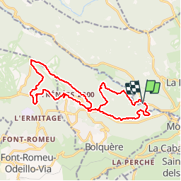
Trail Mountain bike of 18.1 km to be discovered at Occitania, Pyrénées-Orientales, La Llagonne. This trail is proposed by phil21.
Positioning
Country:
France
Region :
Occitania
Department/Province :
Pyrénées-Orientales
Municipality :
La Llagonne
Location:
Unknown
Start:(Dec)
Start:(UTM)
425904 ; 4707718 (31T) N.
Comments