Pays des Tuneux

micheldutilleul
User


3h16
Difficulty : Medium

FREE GPS app for hiking
 SityTrail
IGN / Geographical institutes
SityTrail Plus
The world is yours!
About
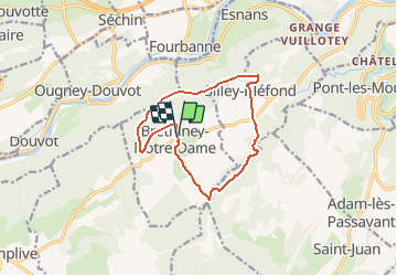
Trail Walking of 11.2 km to be discovered at Bourgogne-Franche-Comté, Doubs, Bretigney-Notre-Dame. This trail is proposed by micheldutilleul.
Description
BRETIGNEY-NOTRE-DAME.
Tantôt dans les bois de feuillus ou de pins, tantôt dans les champs ou dans les prés ; des crêtes dominant le Doubs aux gorges de l’Audeux, découvrez Bretigney et Silley…
Boucle n° 17 Balisage : jaune et bleu
Positioning
Comments