


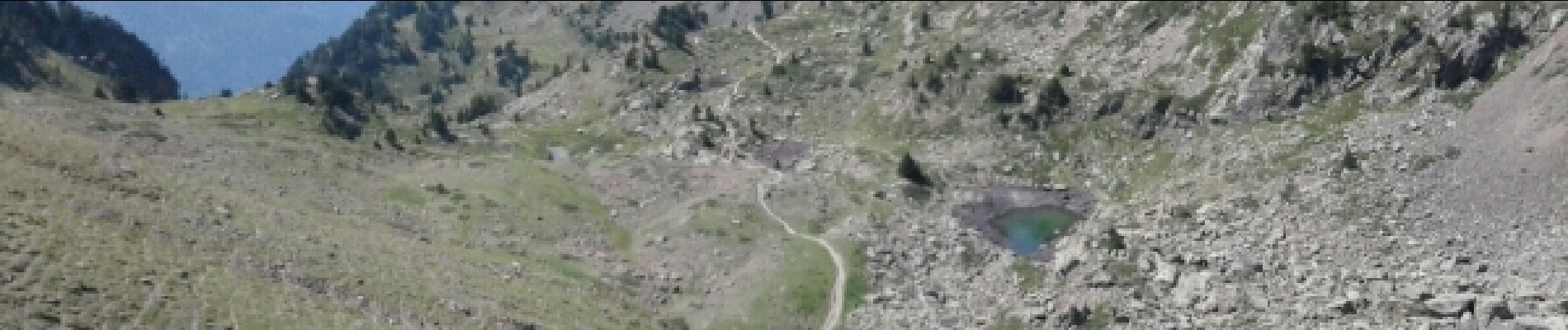
Lacs Robert - CHAMROUSSE

okfred26
User
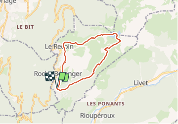

Length
12.7 km

Max alt
2178 m

Uphill gradient
626 m
Km-Effort
21 km

Min alt
1674 m

Downhill gradient
627 m
Boucle
Yes
Creation date :
2017-08-15 00:00:00.0
Updated on :
2022-02-20 19:54:34.347
6h23
Difficulty : Medium

FREE GPS app for hiking
 SityTrail
IGN / Geographical institutes
SityTrail Plus
The world is yours!
About
Trail Walking of 12.7 km to be discovered at Auvergne-Rhône-Alpes, Isère, Chamrousse. This trail is proposed by okfred26.
Photos


Positioning
Country:
France
Region :
Auvergne-Rhône-Alpes
Department/Province :
Isère
Municipality :
Chamrousse
Location:
Unknown
Start:(Dec)
Start:(UTM)
726221 ; 4998724 (31T) N.
Comments