Trail Walking Bourg-Saint-Maurice - sentier Thomas Roques - Photo
© OpenStreetMap contributors
Length
Length
10.2 km
Max alt
Max alt
2757 m
Uphill gradient
Uphill gradient
266 m
Km-Effort
Km-Effort  
17 km
Min alt
Min alt
1775 m
Downhill gradient
Downhill gradient
1229 m
Boucle
Boucle
No
Creation date :
2017-08-05 00:00:00.0
Updated on :
2017-08-05 00:00:00.0

(0 Reviews)

Walking
Walking
4h34
Difficulty : Medium

Scan this QR Code to open this trail in the SityTrail application

FREE GPS app for hiking

Logo SityTrail SityTrail

IGN / Geographical institutes

Download SityTrail from the App Store Download SityTrail from Google Play

Logo SityTrail SityTrail World

The world is yours!

Download SityTrail from the App Store Download SityTrail from Google Play Download SityTrail on Huawei AppGallery

About

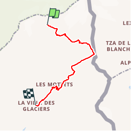
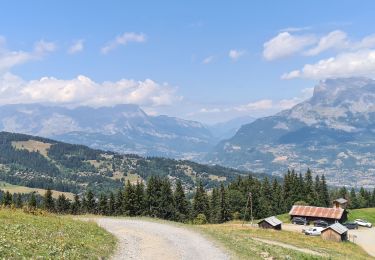
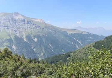
Trail Walking of 10.2 km to be discovered at Auvergne-Rhône-Alpes, Savoy, Bourg-Saint-Maurice. This trail is proposed by reneperrin.

Description

départ du refuge Robert Blanc, col de la Seigne, retour à la ville des glaciers

Elevation profile

Photos

Positioning

Country:
France
Region :
Auvergne-Rhône-Alpes
Department/Province :
Savoy
Municipality :
Bourg-Saint-Maurice
Location:
Unknown
Start:(UTM)
326963 ; 5070384 (32T) N.

Trails nearby

Trail On foot Courmayeur - Alta Via n. 2 della Valle d'Aosta - Tappa 2 - Photo
On foot
PRO

On foot

Medium
Courmayeur, Aosta Valley, Unknown, Italy
17.9 km | 27 km-effort
6h 10min
No
Trail On foot Courmayeur - (SI F07) Rifugio Elisabetta - Courmayeur - Photo
On foot
PRO

On foot

Medium
Courmayeur, Aosta Valley, Unknown, Italy
14.9 km | 25 km-effort
5h 39min
No
Trail Walking Bourg-Saint-Maurice - le lac de Mya, le col des Fours et la tête  sud des Fours - Photo
Walking
GUIDE
amiral13

Walking

Difficult
Bourg-Saint-Maurice, Auvergne-Rhône-Alpes, Savoy, France
12.3 km | 26 km-effort
6h 20min
Yes
Trail Touring skiing Les Contamines-Montjoie - tricotage vers la pointe de Chaborgne  - Photo
Touring skiing
nadd73

Touring skiing

Easy
Les Contamines-Montjoie, Auvergne-Rhône-Alpes, Upper Savoy, France
11.1 km | 27 km-effort
5h 12min
Yes
Trail Touring skiing Les Contamines-Montjoie - Pointe Nord du Mont Jovet - Photo
Touring skiing
nadd73

Touring skiing

Medium
Les Contamines-Montjoie, Auvergne-Rhône-Alpes, Upper Savoy, France
21 km | 38 km-effort
6h 2min
Yes
Trail Touring skiing Les Contamines-Montjoie - col de la Cigle  - Photo
Touring skiing
nadd73

Touring skiing

Medium
Les Contamines-Montjoie, Auvergne-Rhône-Alpes, Upper Savoy, France
14.8 km | 30 km-effort
4h 30min
Yes
Trail Walking Les Contamines-Montjoie - Le Lay - Le Déchappieu - Photo
Walking
marionneau

Walking

Medium
Les Contamines-Montjoie, Auvergne-Rhône-Alpes, Upper Savoy, France
15.2 km | 26 km-effort
4h 13min
Yes
Trail Walking Les Contamines-Montjoie - Le Lay - Gorges de la Gruvaz - Photo
Walking
marionneau

Walking

Easy
Les Contamines-Montjoie, Auvergne-Rhône-Alpes, Upper Savoy, France
13.9 km | 22 km-effort
3h 29min
Yes
Trail Walking Les Contamines-Montjoie - Le Lay - Combe d'Armancette - Photo
Walking
marionneau

Walking

Medium
Les Contamines-Montjoie, Auvergne-Rhône-Alpes, Upper Savoy, France
13.5 km | 26 km-effort
4h 26min
Yes


Close
My subscriptions